Overview
Duration :
29 Days
Secondary Activity:
Nature and Culture
Max altitude :
5,160 m/16, 924 ft
Transportation:
Private Vehicle
Trip ends in:
Kathmandu
Accomodation:
Hotel and Lodge
Primary activity:
Trekking and Hiking
Group Size:
Min. 2 pax
Country:
Nepal
Trip starts from:
Kathmandu
Diffficulty:
Strenuous
Meals:
Nepali and Continental
Best Season:
Autumn and Spring
Trip route:
Kathmandu- Gorkha- Barpak-Laprak-Khorlabeshi-Jagat-Lokpa-Chumling-Gumba Lungdang-Chhokang Paro- Mu Gompa-Rachen Gompa-Chumling-Deng-Namrung-Lho-Samagaon-Samdo-Dharamsala-Larkya la Pass-Bhimtang-Gho-Tal-Besisahar-Kathmandu
Trip introduction
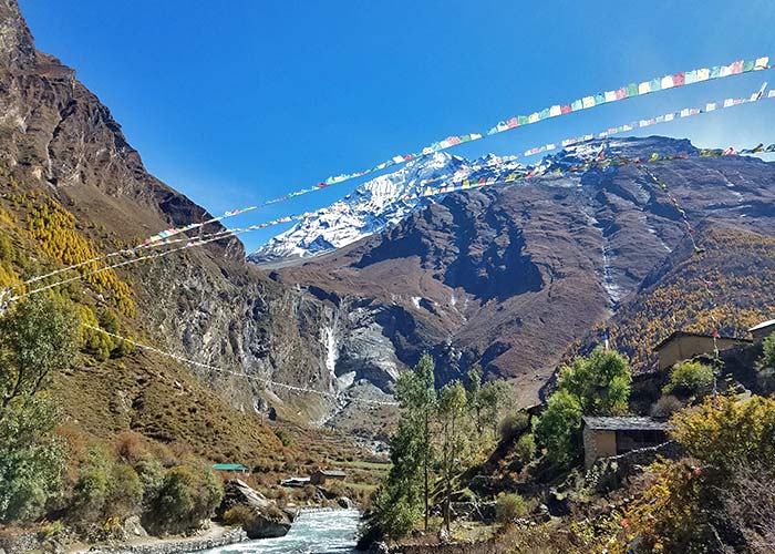
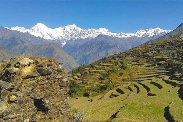
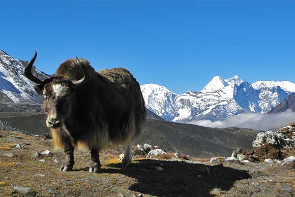
Manaslu Tsum Valley Trek provides us with a wonderful opportunity to escape ourselves through daily routine and completely immerse in the natural beauty around the 8th highest Manaslu Himalayas with cultural exploration at the hidden valley of Tsum. With less than a decade of its opening to outsiders, Tsum Valley has been successfully able to enchant visitors; with its diversity in topography and richness in Tibetan-influenced cultures and traditions.
Overview of Manaslu Tsum Valley Trek
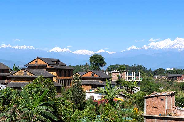
We embark on the Manaslu Tsum Valley Trek as you arrive at Kathmandu and complete sightseeing around world heritage sites. At the beginning of the trek, we take a drive to Baseri, the starting point of this trip. We pass through, an exceptionally beautiful and naturally blessed Budhi Gandaki valley. Likewise, trekking along the way through beautiful forests, farmlands, pastures, settlements, and villages of mostly Gurungs and Magars; we enter the hidden Tsum valley leaving back the Manaslu Trail.
Tsum Valley
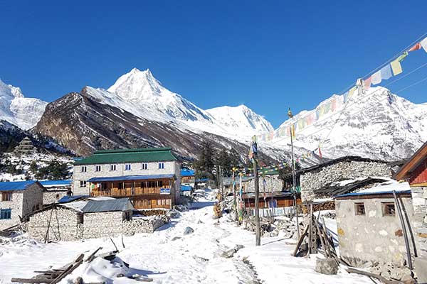
Tsum Valley is popular for its outstanding views of Himalayan ranges like Ganesh Himal and Manaslu etc. Along the way, we pass through numerous Buddhist monasteries watching the Tibetan-influenced cultures. Tsum Valley also offers insights into the lifestyle of tribes living there which will surely be a cultural shock to outsiders.
Manaslu and Tsum Valley is a well-known homestay trek. But in the present scenario, plenty of tea houses also have developed around the trails. During the final days of the trek, we again catch up on the popular circuit route of Tal, and Syange, and drive back to Kathmandu.
Join this trek with Nepal Mountain Trekkers for professional arrangements. From lodging, food, safety, and others that make your trekking in Nepal holiday a memorable one. Simply fill out the Booking form and let us know about your interest. Or you can contact us directly by sending us an email to join this amazing trek in Manaslu Region.
Special Note:
If this itinerary doesn’t suit your requirement or if you want to customize it, please feel free to contact us. This trek could be customized as per your required time frame and budget limits.
The Manaslu Tsum Valley Trek can now be accomplished within 18-21 days as well so if the itinerary on our website is not favorable, please feel free to reach our to us for customization.
Overview
-
Day 1Arrival in Kathmandu (1,365 m / 4,478 ft):
-
Day 2Kathmandu: Sightseeing and Trek Preparation:
-
Day 3Kathmandu to Gorkha (1,060 m / 3,478 ft):
-
Day 4Gorkha to Barpak (1,915 m / 6,263 ft):
-
Day 5Barpak to Laprak (2,100 m / 6,890 ft):
-
Day 6Laprak to Khorlabeshi (970 m / 3,182 ft):
-
Day 7Khorlabeshi to Jagat (1,340 m / 4,396 ft):
Note: Nowadays, we can drive up to this location (Jagat) from Kathmandu within a single day. Please feel free to mention in your email if you prefer to shorten the program.
-
Day 8Jagat to Lokpa (2,240 m / 7,350 ft):
-
Day 9Lokpa to Chumling (2,386 m / 7,828 ft):
-
Day 10Chumling to Gumba Lungdang (3,200 m / 10,498 ft):
-
Day 11Day Hike to Landan Kharka(3,740m / 12,270 ft):
-
Day 12Gumba Lungdang to Chhokang Paro (3,031 m / 9,945 ft):
-
Day 13Chhokang Paro to Mu Gompa (3,709 m / 12,168 ft):
-
Day 14Day Hike Bhajyo (4,030 m / 13,222 ft):
-
Day 15Mu Gompa to Rachen Gompa(3,240 m / 10,630 ft):
-
Day 16Rachen Gompa to Chumling (2,386 m / 7,828 ft):
-
Day 17Chumling to Deng (1,860 m / 6,102 ft):
-
Day 18Deng to Namrung (2,630 m / 8,628 ft):
-
Day 19Namrung to Lho (3,180 m / 10,433 ft):
-
Day 20Lho to Samagaon (3,520 m / 11,548 ft):
-
Day 21Acclimatization Day at Samagaon:
-
Day 22Samagaon to Samdo (3,875 m / 12,713 ft):
-
Day 23Samdo to Dharamsala (4,460 m / 14,632 ft):
-
Day 24Dharamsala to Bhimtang (3,590 m / 11,778 ft) via Larkya La Pass (5,160 m / 16, 930 ft):
-
Day 25Bhimtang to Gho (2,515 m / 8,251 ft):
-
Day 26Gho to Tal (1,700 m / 5,577 ft ):
-
Day 27Tal to Kathmandu via Besisahar(760 m / 2,493 ft):
-
Day 28Relax Shopping and Explore Day at Kathmandu with Farewell Dinner in the Evening:
-
Day 29Departure Day:
Detail Itinerary
Day 1 : Arrival in Kathmandu (1,365 m / 4,478 ft)::
As soon as you arrive at the Tribhuvan International Airport, Kathmandu, and pass the immigration, you will see our representative waiting for you with your name and marigold flower to welcome you to Nepal. He will be transferring you to the hotel in the private vehicle of our office.
Day 2 : Kathmandu: Sightseeing and Trek Preparation::
After having your early meal, you will start your day with a visit to the Nepal Mountain Trekkers office at Thamel. After being introduced to our team including the tour guide, trekking leader, and director of operations, you will head for necessary trekking preparations, getting needed equipment with the initiation of Kathmandu sightseeing around world heritage sites. Kathmandu Durbar Square, Swayambhunath Stupa, Pashupatinath Temple, and Boudhanath Stupa are UNESCO world heritage sites that you will explore till sunset.
Day 3 : Kathmandu to Gorkha (1,060 m / 3,478 ft)::
After having breakfast, you will be traveling in a comfortable jeep from Kathmandu to Gorkha from where your real trekking days would begin. Gorkha is a good place to start the Manaslu Circuit – easier to get to than Arughat – the road from Dhading to Arughat is dreadful – Gorkha is about 400 meters higher than Arughat (cooler) – and it is really worthwhile climbing up from Gorkha town center to the palace and temple on the ridge above with great views of the mountains including the Manaslu Massif.
Day 4 : Gorkha to Barpak (1,915 m / 6,263 ft)::
Your jeep will drive you to Barpak – the real start of your trek and a big prosperous village that was the epicenter of the earthquake in April 2015 – it was badly damaged – most of the houses had heavy stone (slate) roofs that collapsed all too easily during the earthquake causing death and serious injury. Now there are many temporary tin buildings in Barpak– houses, shops, and schools. Ironically in some ways, Barpak was lucky – being the epicenter it became the focus of national and international relief efforts – it took many days for help to reach other severely damaged more remote villages.
Day 5 : Barpak to Laprak (2,100 m / 6,890 ft)::
A lovely walk up over a ridge – Mamche (2,700 meters) – with great views of Ganesh Himal and then down to Laprak. Laprak was also badly affected by the earthquake. Its current site has been assessed as being unsafe – too prone to landslide and as a result, a huge project is underway to build New Laprak. Coming down from Mamche, you will come to New Larprak first. It is 500 meters above Old Laprak. Contractors are in the process of building a ‘housing estate’ of hundreds of identical small four-roomed houses (ground floor area of 6.9m x 4.35m) – using specially designed (CSEB) concrete blocks, steel reinforcing rods, metal trusses, and corrugated iron for the roof. A few of the houses were nearing completion. Old Larprak is quite a large village – there were no obvious signs of it getting ready to move to the new site.
Day 6 : Laprak to Khorlabeshi (970 m / 3,182 ft)::
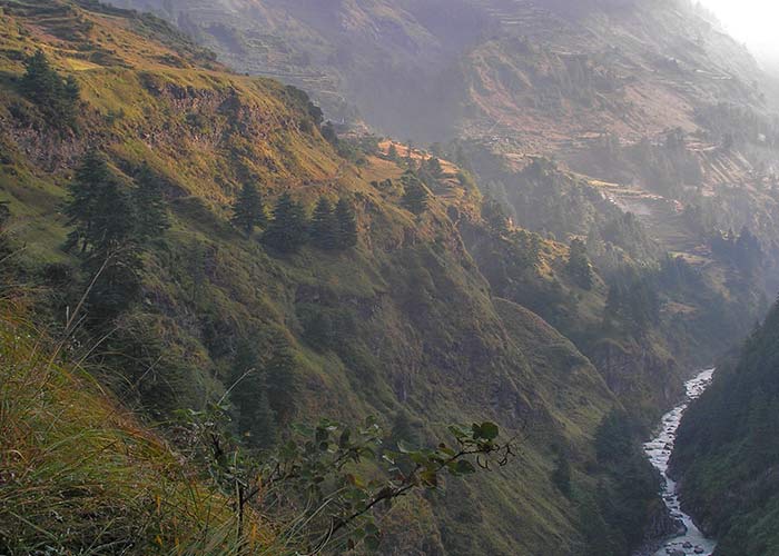
From Laprak you will walk down and then up to Singla, then a bit down to Khorla where you will have lunch at a very simple restaurant, before dropping steeply down to Khorlabeshi beside the thundering Budi Gandaki.
Day 7 : Khorlabeshi to Jagat (1,340 m / 4,396 ft)::
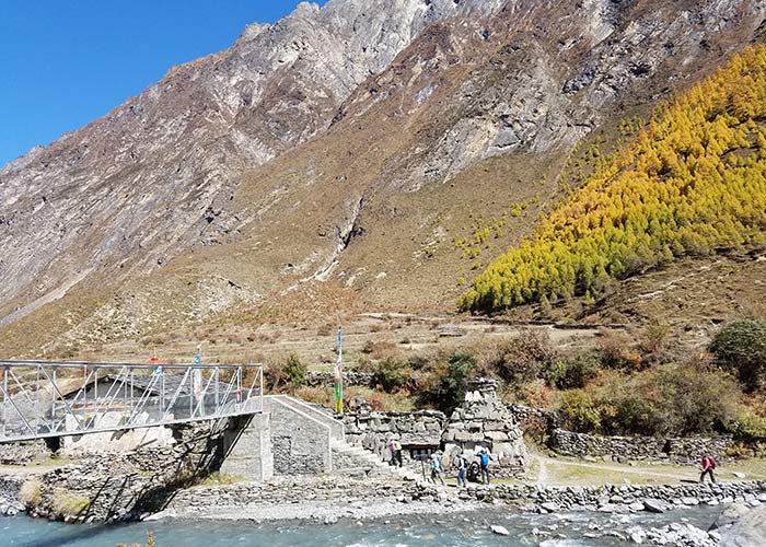
An easy walk from Khorlabeshi, crossing the Budhi Gandaki several times – one section being a cantilevered metal walkway across a cliff face above the Budhi Gandaki replacing a section of trail that was lost as a result of the 2015 earthquake. Jagat feels like a compact trading post in a narrow section of the Budhi Gandaki gorge. You might catch a glimpse of Shringi Himal ahead.
Note: Nowadays, we can drive up to this location (Jagat) from Kathmandu within a single day. Please feel free to mention in your email if you prefer to shorten the program.
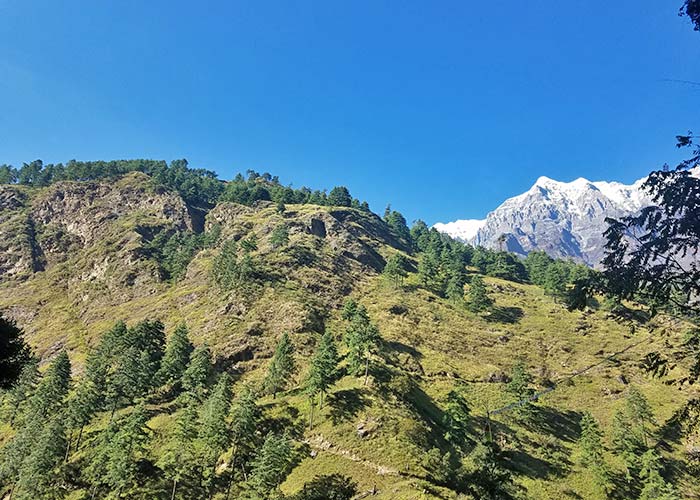
Day 8 : Jagat to Lokpa (2,240 m / 7,350 ft)::
An easy walk to Ekle Bhatti for lunch and then a beautiful climb up through Bhutan pine forest with flowers including lovely delicate delphiniums to the only lodge at Lokpa, which is 300 meters below the main village. The lodge is not great and is often full – Lokpa needs another lodge!
Day 9 : Lokpa to Chumling (2,386 m / 7,828 ft)::
The walk from Lokpa to Chumling is more challenging than you might expect. It involves a lot of steep up and down. You realize by the end of it why Tsum Valley has remained isolated until very recently. You cross another newer section of the cantilevered metal walkway across a cliff face. The collapse of this section of the trail in 2016 left Tsum Valley almost cut off from Nepal for a few months. A while before you arrive in Chumling you cross a suspension bridge over the Shiar Khola and one more climb brings you up into a more open valley and you can see why people have chosen to live in such an inaccessible place for hundreds of years – plenty of terraced fields on the north side and mature Bhutan pine forest on the south side of the valley. Just before we arrived, we were greeted by two sweet little boys, who offered us bouquets of wildflowers. The Tashi Delek Hotel at Chumling has been open for less than a year and is really comfortable and well-run. One small criticism – it could do with another toilet! That afternoon we visited the new health post in Chumling designed by Sonam and amazingly met Sonam and Sherab on their way to show other visitors the health post. We joined the tour – the new clinic is beautiful and built following the earthquake resilience principle– with dressing dry stone walls with timber ring beams; traditionally carved Bhutan Pine windows and doors, green corrugated iron roof, and cleverly designed bamboo panels closing off the void under the eaves.
Day 10 : Chumling to Gumba Lungdang (3,200 m / 10,498 ft)::
It’s a lovely easy walk from Chumling to Dumje – most of the time you are high above the Shiar Khola. Just after crossing a suspension bridge and just before Dumje you leave the main trail to Chhokang Paro and cross a wooden bridge over the Shiar Khola. From Dumje you climb steadily and sometimes steeply up, about 1,000 meters, through a mixed forest of pine, hemlock, and birch to Gumba Lungdang. On the way, if it is clear you should see Ganesh 1 and 2 and Lumbo Himal as well as more distant views of Himal Chuli and Nadi Chuli. The monastery and the accommodation there were almost completely destroyed by the earthquake in April 2015. For the next year or so, while the reconstruction is underway, if you want to stay at Gumba Lungdang it is best to carry your own tents. There are three small tents there but like most heavily used tents their zips are failing. The nuns are hospitable and will feed you well but please don’t be too demanding – their lives must be hard enough already. Awesome views of sunset on Ganesh 1 and sunrise on Ganesh 2 are possible from Gumba Lungdang but for us, it was cloudy and only partially cleared before we left.
Day 11 : Day Hike to Landan Kharka(3,740m / 12,270 ft)::
Today you will acclimatize and hike up to Landan Kharka to explore more beauty from a higher altitude. To be more precise, you will hike up for the marvelous view of Ganesh Himal.
Day 12 : Gumba Lungdang to Chhokang Paro (3,031 m / 9,945 ft)::
First, you have to retrace your steps down to Dumje and re-join the main trail. We had lunch in Gho shortly after rejoining the main trail and then climbed up to Chhokang Paro – crossing some landslide areas requiring extra care. We stayed in the Tashi Delek Hotel, which is a large and well-run hotel with comfortable rooms, a beautiful dining room, and a naughty but nice – gas boiler hot shower. You can see the sunrise on Baudha Himal and Himal Chuli from the hotel. With a lot of help from a kind local man, we managed to find Sonam’s family home and stayed for Masala tea and cookies with Pema (Sonam’s half-brother) and Pema’s mum. Look out for the café – Tsum Valley Café. You can get delicious espresso, cappuccino, macchiato, etc – Pema had been a barista at Himalayan Java in Kathmandu. This is a delightful treat in Chhokang Paro!
Day 13 : Chhokang Paro to Mu Gompa (3,709 m / 12,168 ft)::
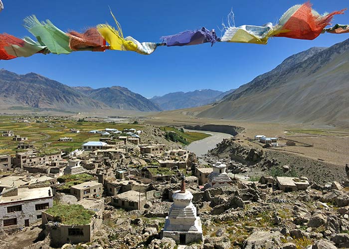
From Chhokang Paro to Mu Gompa there is a road – not joking – there is a road but there are no buses, cars, or motorbikes – just one tractor. It is said that one day this road will connect Arughat to Tibet – we will see. The easy walk from Chhokang Paro to the Nile is through beautiful, fertile, large, flat fields – the amazing and valuable productive land of the upper Tsum Valley. Lots of Chortens, mani walls, and gompas on the way – leaving you in no doubt that you are amongst Buddhists. Beyond the fields, to the east and west, the near-vertical walls of the valley become the snow-capped, 6,000-meter peaks of Cherke Himal, Kipu Himal, and Langju Himal. After the Nile, the valley narrows and the fields cease. Mu Gompa was busy with trekkers – the rooms were full so we had to pitch our tents. The Gompa is perched upon an east-facing slope, austere but well-maintained. You can climb up a bit further to a nunnery not far from Mu Gompa or for the really energetic you can climb at least another 1,000 meters above the monastery for great views. If you are lucky, from Mu Gompa, you can see sunset and sunrise on Ganesh 2 to the south.
Day 14 : Day Hike Bhajyo (4,030 m / 13,222 ft)::
The walk further north to Bhajyo is on the road for the first hour. Then you have to cross two short but unstable and a bit scary landslide areas. After that the trail is easy – through yak Kharkas with blue sheep and marmots grazing in the sunshine – the slopes above and below are covered in shrubs showing their autumn colors – berberis rose and dwarf cotoneaster. You can tell from the quantity of litter that Bhajyo becomes a very busy small town during May – the Yarsagumba gathering season. Almost all of the litter comes from Tibet, China – which is only an easy 3 hours walk away. The cans and bottles should go back to China on the mules that brought them into Nepal and be recycled. Having cleared some of the litter, we pitched our tents and repaired one of the dry stone walled, tarpaulin-covered shelters abandoned by the Yarsagumba gatherers to use as our kitchen. Bhajyo is a beautiful spot – a great place to relax amongst the high mountains in the afternoon sunshine – Langju Himal and Tabsar look spectacular – but bitterly cold in the shade first thing in the morning. Thanks to Min, D.B., and Bikash we managed to enjoy soup, spaghetti with sweet chili and tomato sauce, various noodles, 3 in 1 coffee, and peppermint tea – perfect. After lunch, we walked up beyond Thongbu (4,500 meters) to get a clear view of the pass and a Chorten on the border between Nepal and China. D.B. and Bikash would love to have walked right up to the border but sadly we didn’t have time.
Day 15 : Mu Gompa to Rachen Gompa(3,240 m / 10,630 ft)::
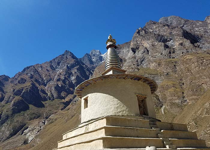
The next morning you will retrace your steps to Rachen Gompa exploring Buddhist Culture with a look around Chortens, Mani Walls, Mani Stones, Prayer flags, and so on. Rachen Gompa is a famous monastery run by Nuns.
Day 16 : Rachen Gompa to Chumling (2,386 m / 7,828 ft)::
Again you will retrace your steps back to the lovely Chumling with views of Shringi Himal stopping for coffee, masala tea, and cookies in Chhokang Paro. This day you will be walking the previous route enjoying the same view from a different angle.
Day 17 : Chumling to Deng (1,860 m / 6,102 ft)::
From Chumling you will endure the arduous walk back to Lokpa and then drop easily down through the forest to re-join the main Manaslu Circuit trail to reach Deng. The main trail squeezes its way through the Budhi Gandaki gorge crossing the river several times on long suspension bridges.
Day 18 : Deng to Namrung (2,630 m / 8,628 ft)::
Today you will be following the main trail to Bihi Phedi or a slightly longer route up to Bihi Village – a proper village very close to the Manaslu Circuit trail, but without any lodges, it seems hardly any trekkers. Beyond the village, you will descend steeply back down to the main trail and then on to Ghap for lunch. After Ghap the Budhi Gandaki valley widens. At one point you will cross a suspension bridge over the river and from the bridge you can see the Budhi Gandaki forced under a natural stone arch. Then it’s a sustained climb up a beautifully built stone staircase to Namrung. Surprisingly Namrung has a very smart-looking and luxurious (presumably) but expensive hotel.
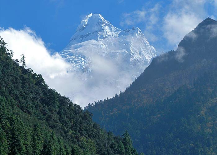
Day 19 : Namrung to Lho (3,180 m / 10,433 ft)::
An easy half days walk to Lho with great views of Himalchuli at the head of Hinang Glacier before Sho- famous for apples. In the afternoon you will walk up to the large and prosperous-looking Ribung Monastery and climb up to the top of the hill behind, for clear views of the Manaslu Massif. You can also walk up a short distance from the hotel to a popular viewing point near Ribung Monastery to watch the magnificent sun rising on Manaslu.
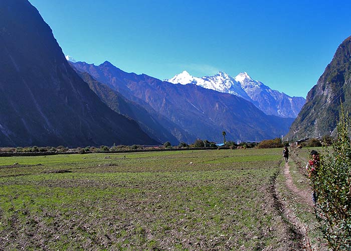
Day 20 : Lho to Samagaon (3,520 m / 11,548 ft)::
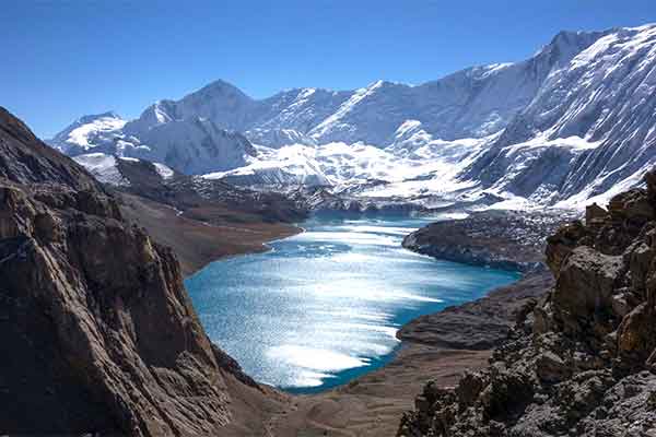
After breakfast, you will make an easy half-day walk to Samagaon to photograph another classic view of Manaslu with a Chorten in front of it near Lho and then stop for tea at Shyala, a sleepy village, with magnificent clear views of Himalchuli, Nadi Chuli, Manaslu, Naike peak, Larkya peak, and Samdo and Saula Himal. In the afternoon you will walk up to Birendra Tal – about an hour’s walk from Sama.
Day 21 : Acclimatization Day at Samagaon::
Today you will rest in Sama for acclimatization and if you can then manage the four-hour walk up to Manaslu Base Camp (4,770 meters) – a truly amazing spot with spectacular views of Manaslu, Manaslu North, and Naike Peak. The base camp is a collection of large yellow tents with a kitchen and dining tent.
Day 22 : Samagaon to Samdo (3,875 m / 12,713 ft)::
Another very easy walk from Sama to Samdo still following the much-diminished Budhi Gandaki – no fields and no big trees – just some small birch, juniper, and larch trees and lots of scrubby bushes including berberis and rose.
Day 23 : Samdo to Dharamsala (4,460 m / 14,632 ft)::
A beautiful and, apart from the altitude, easy walk up to Dharamsala with truly impressive views of Samdo Peak, Naike Peak, Larke Peak, Cheo Himal, and briefly Manaslu and Manaslu North.
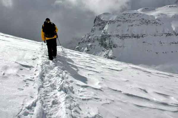
Day 24 : Dharamsala to Bhimtang (3,590 m / 11,778 ft) via Larkya La Pass (5,160 m / 16, 930 ft)::
Along the rough rocky trail, across the glacial moraine with wonderful views of sunrise on Larke Peak, you will make your way towards Bhimtang with prayer flags blowing in the wind along steep and in places icy zigzag descent. You can enjoy fine views from Bhimtang of sunset on Manaslu as well as Phungi Himal, Nadi Chuli, and Cheo Himal. Himlung, Ponkar Peak, and Kang Guru.
Day 25 : Bhimtang to Gho (2,515 m / 8,251 ft)::
You will cross both lateral moraines and the river of meltwater emerging from Salpudanda Glacier before descending through mature forest mainly of silver fir on the other side of the glacial valley from Bhimtang. As you lose height, the forest changes later dominated by hemlock and then Bhutan pine. There are clearings and fantastic views back to the Cirque of white-fluted peaks. You will stop for lunch at Kharche – a Kharka in the forest where red-berried cotoneaster trees predominate. Finally, you will reach Gho, a proper village with fields of buckwheat and millet, cattle, and sheep.
Day 26 : Gho to Tal (1,700 m / 5,577 ft )::
From Gho, you will be dropping rapidly and easily mostly on a newly cut but unused road down to Dharapani where you will join the Annapurna Circuit trail. After a pleasant walk down to Tal getting used to the unfamiliar site of 4-wheel drive vehicles heading up to and down from Manang, you will arrive at the beautiful Tal, happily off the main road, with delightful waterfalls, pretty gardens, and great excitement.
Day 27 : Tal to Kathmandu via Besisahar(760 m / 2,493 ft)::
The first part of the walk down from Tal is beautiful – a steep zigzag trail down beside the thundering Marsyangdi trapped in a deep vertical-sided gorge to Chamje. The road on the other side of the river has been cut into the cliff face high above the river and even makes a three-quarter turn around a tower of rock – a lapse in the driver’s concentration would be lethal. From Chamje the rest of the walk is on the road and mercifully fairly short. Then you will enjoy the drive down to Besi Sahar admiring the views of the impressive Chinese hydroelectric project at Nadi Bazar and of the Manaslu Massif now some distance away but still completely clear. In Besi Sahar, you will change to a comfortable car for the drive to Kathmandu.
Day 28 : Relax Shopping and Explore Day at Kathmandu with Farewell Dinner in the Evening::
Today is all yours, you can go shopping and explore the nearby places during the daytime and in the evening you will be taken out for a farewell dinner as a complimentary treat by Nepal Mountain Trekkers.
Day 29 : Departure Day::
Today will be your final day in Nepal, as we drop you at International Airport for your scheduled international flight towards your onward destination.
Price Includes
- Airport Pick-up and drop service
- 4 nights Hotel in Kathmandu (Hotel Green Horizon or similar standard)
- All accommodation during the trek in the best hotels/tea houses in the area (differing according to the price you wish to spend)
- Sanitation: The accommodation we provide will be neat and clean with warm hospitality and quality services.
- Single/Twin-sharing Accommodation (as per budget): Your group won’t have to share your accommodation with anyone else so your privacy is protected.
- All foods during the trek: Breakfast, Lunch, and Dinner; any items on the menu as much as you wish to consume.
- We provide hygienic and safe meals to re-energize you.
- We request you not to waste your meals for it is difficult to transport food in the rural area.
- You are not allowed to share your meals with anyone else from another group.
- Transportation costs: Comfortable Drive from Kathmandu to Trek Start Point(Gorkha/Barpak) and Jeep Drive from Tal to Besisahar and Private Vehicle from Besisahar to Kathmandu
- Professional and Highly experienced English-speaking Trekking Guide licensed by the Government. Including their lodging and food.
- Local Staff: Our guides are locals of the region which ensures that you will surely get to explore a bit more during the trek than with any other guides.
- Experienced: With the experience of more than a decade of working in this field, our trekking guides possess excellent knowledge of briefing during the trek as well as they are experts in handling all kinds of critical situations that might occur during the trek.
- Insurance: Nepal Mountain Trekkers have an insurance policy for all our trekking staff.
- Porters (1 porter for 2 trekkers with a max load of 25 KG). Including their lodging and food.
- Local Staff: The porters we hire belong to the same region where we trek in order to provide employment opportunities to the locals as well as to make you explore every prospect of the region.
- Trekking permits: Manaslu Conservation Area fees, Manaslu Special Permit (Seven Days Only), Tsum Valley Special Permit (Eight Days Only), Annapurna Conservation Permit, and TIMS card
- First aid medical box
- All required trekking gear like Sleeping bags and down jackets made available on rent
- T-shirt, Duffel Bag, and Trekking Map with company logo
- Rescue Management Service
- 13% VAT and 10% company service charge
- Farewell Dinner
Price Excludes
- Visa fee to enter Nepal (Visa Information)
- International flight tickets and extra baggage charges
- Extra night accommodation and meal costs in Kathmandu due to any change in the scheduled itinerary
- Travel insurance/ Rescue operation costs
- All personal expenses (laundry, electronic device charging cost, all alcoholic beverages, and soft drinks, etc)
- Tip for guide and porters
Trip Gallery
Trip Map:
Equipments
 Head
Head
- Sun hat or scarf
- Light balaclava or warm fleece hat
- Sunglasses
- Head Torch
- Suncreams(40+) and Lip Balms
Upper Body
- Cotton t-shirts and thermals
- Fleece jacket
- Waterproof jacket
- Down jacket
Lower Body
- Lightweight cotton pants (long)
- Waterproof pants
- Inner thermals
Feet
- Thin inner socks (3 pairs)
- Thick, warm wool hiking socks
- Comfortable hiking boots
- Shower sandals
Hands
- Gloves (Cotton and Waterproof)
- Creams
- Sanitizer
Accessories
- Sleeping bag rated to -10°C +
- Trekking bag (Rucksack)
- Duffel bag
- Large plastic bags (for keeping items dry inside trek bag)
- Trekking poles (optional, recommended)
- Water bottle or camel bag
- Toiletries and Tissue Papers
First Aid Kits
- Personal Regular Medicines
- Knee Caps
- Bandages
- Ointments
- Blister Tape
Related Trips
You will also like …
Ganga Jamuna Gorkha Trek
- 14 days
- Moderate
Gorkha Bandipur Adventure Tour
- 10 Days
- Moderate
Dhaulagiri plus Upper Mustang Trek
- 29 Days
- Strenuous
Annapurna Round Tilicho Lake plus Poon Hill Trek
- 20 Days
- Strenuous
Rupina La Plus Larke Trek
- 25 Days
- Strenuous
Manaslu Circuit Trek
- 17 Days - Customizable
- Moderate


